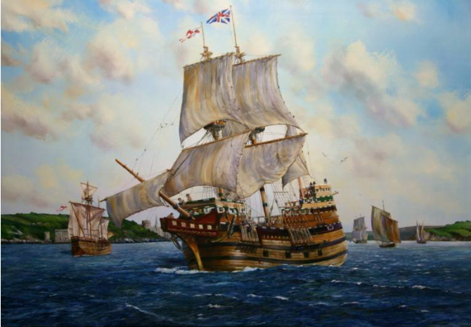
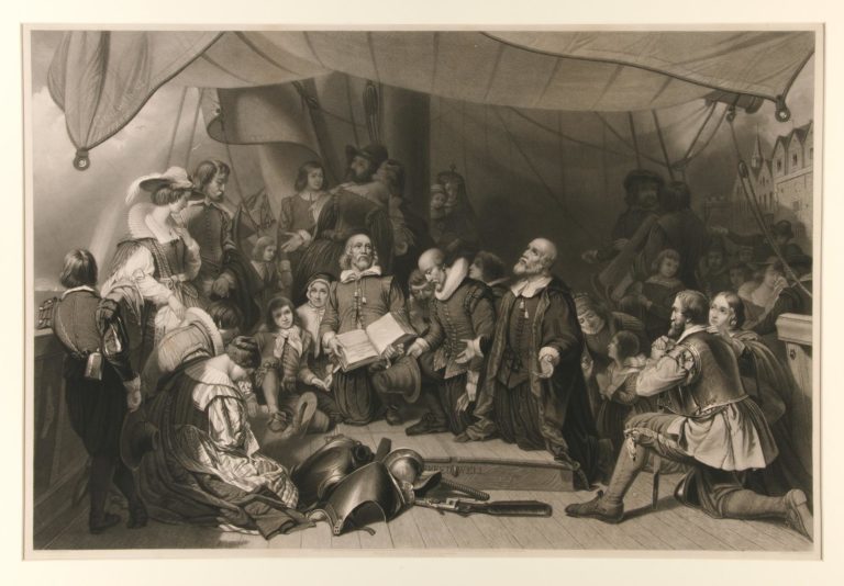
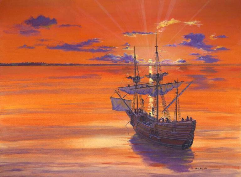
The Mayflower Voyage
Navigation in 1620: The Mayflower Was One of the Lucky Ones
From Diamond Jubilee Edition 27
Robert A. Harper
Presented at a meeting of the Myles Standish Colony of the Florida Society, in Naples, Florida
When I first thought of discussing the art of navigation in 1620 and how Captain Christopher Jones of the Mayflower probably employed that art, I was thinking primarily about the “tools of the trade” then in use. I had read a bit about them and knew they were pretty crude and inaccurate from a present day point view. Still I had not realized how few and simple and crude these tools really were!
More importantly it had not occurred to me to think at all about the unusualness of an ocean crossing in those times. Of course, I knew that Columbus had made it and that Magellan’s lieutenant had finally finished the first circumnavigation of the globe a hundred years earlier in 1523 (after losing four out of five of his original fleet of ships and all but eighteen of his original crew of some three hundred men). But I had not put the hiring of a commercial trading ship like the Mayflower for ocean passage into its proper perspective. While it wasn’t as breathtaking or history making perhaps as modern space explorations, it would certainly have had everyone “glued to the tube” if TV had then existed. Now, why is that?
It is hard for us in this present age to imagine what it would be like not to know certain things – not know how wide the oceans were; – not to know how far Virginia was from Plymouth, England; – or from Plymouth, Massachusetts, for that matter; not to know, even, how far a ship would sail in a day or a week, and not to have any maps or charts of a good degree of accuracy for any country or any ocean on earth. All of this lack of knowledge was the situation 1620.
Now, of course, there was much sea-faring in 1620. Ships plied the English Channel, sailed up and down the coast of France and Spain and swarmed all over the Mediterranean. But this was mainly coastal, short voyage work. In any trip the length of time out sight of land was minimal. This is not to say that there were not trans-ocean voyages in the period. The gold trade between Spain and Mexico had flourished for years. The cost in lives and ships and cargo had been and continued to be terrific. The many recent treasure finds from sunken Spanish galleons in waters near Florida bear vivid witness to the awful costs of these many passages. These costs in men, ships and cargo were due in great degree to the ignorance of the crews and skippers and navigators. In those days the practitioners of the sea-faring art had no ability to determine accurately, on a day to day basis, their ship’s position or what dangers lurked.
So much for the state of the art in 1620. What do we find as to how many of these meager skills were possessed by Captain Jones and his crew aboard the Mayflower?
We know that Captain Jones was a part owner of the ship and had been Captain for several years. He had just returned from Spain, hauling a cargo of wine. He had traded at least once across the North Sea to Norway from Newcastle. He was probably as well suited to, and trained for, an Atlantic crossing as the average sea captain of the day. To understand just what is involved in making a crossing, whether back then or today, it is necessary to get a bit technical and describe some of the essentials of navigation and passage making in any age.

When out of sight of land, the navigator depends on several aids to keep his ship on course and to position her daily on the surface of the ocean. Then, as now, the first aid is the compass. With it he can shape his course steadily toward his destination. All of us know something about a compass, and how its north-seeking needle points to magnetic north. The discovery and use of the magnetic properties of ferrous compounds goes way, way back in time. One of the first references to a mariner’s compass is found in the writings of one Alexander Neckam, born in A.D. 1157. We are sure its use antedated this date by years and perhaps centuries.
The next aid is the traverse board. This is a kind of abacus and memo pad. A circle at the top of the board is divided by radii into the thirty-two points of the compass. Each of these radii has eight holes, evenly spaced out from the center, into which pegs can be fitted. The bottom of the board is divided by eight horizontal lines and these lines also have holes evenly spaced across their length for pegs. Then, as now, a steering watch was four hours long, divided into eight 30 minute glasses of time. At the turning of each glass (every thirty minutes), the quartermaster put a peg in the proper radius hole to represent the average course steered during the period and the proper glass number of the watch period.
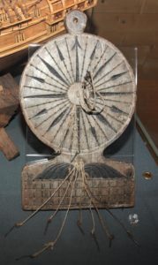
Since the navigator knew where he had come from, this daily reckoning let him deduce his daily position. From the word deduce we get our present term Dead Reckoning or DR Position.
How did the navigator measure his speed as mentioned above? The log ship (chip?) consists of a marked line (knots tied every so often on it), fastened to a triangular piece of wood, the ship, weighted at one side so it would float upright in the water. Being vertical as it floated, it would, theoretically at least, remain stationary in the water as the ship sailed away from it and the marked line ran out so many knots in so many seconds, measured by a glass. Since the knots were calculated at a certain distance apart, a count of them in the measured time gave the miles per hour directly.
This sounds quite impressive, but the results were far from anything but rough guesses. They were at least better than no guess at all. So, with compass, traverse board and log-ship, the 1620 navigator kept his accompt book of daily positions – his dead reckoning positions. Even today, with much better compass, perfect timing devices, and excellent speedometers, the position of a ship at sea by dead reckoning may be off by a substantial mileage each day.
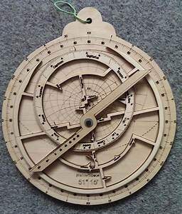
This leads us to the next aid the navigator must have. He must have a way of figuring his position from day to day by means independent of course or speed. The aid he uses to do this is an altitude measuring device with which he can determine the altitude of some heavenly body and, with suitable calculations, find from this measurement his location at sea. In 1620 the aids used were either an astrolabe or a Davis backstaff.
This is where Celestial Navigation comes into the picture. Celestial Navigation, in all its mathematical and astronomical theory, is rather complicated but its basic principal is simplicity itself. Poets have referred to the heavenly bodies – the sun, moon, stars and planets – as the “Lighthouses of the Sky” This poetic fancy happens to be strict, practical fact. Consider for a moment. We are on the revolving earth. It revolves from west to east, and this motion makes it appear to us that the sun and all other bodies rise in the East and set in the West. Imagine, if you will, a string running from the center of the earth to the center of a heavenly body. This string would cut the surface of the earth at a certain point at a certain time. This point is called the “GP” of the body. “GP” stands for “geographical position.” It keeps changing from moment to moment as the earth turns. Today the GP’s of fifty-seven navigational stars, four planets, the moon and the sun are listed in a Government publication issued annually and called the Nautical Almanac. This book lists these positions in terms of degrees North or South of the equator, and degrees West of an arbitrary line running through Greenwich, England. They are listed for every second of time of the year.
In 1620 no such handy volume existed. Tables of the “Declination of the Sun” for every day of the year were available, however. Declination is merely the astronomer’s name for latitude and refers to the latitude on the earth’s surface of the GP of the body. Now, remember a heavenly body moves westward in the sky rapidly, about 15 degrees an hour, but it moves slowly north or south. So a daily table of the sun’s declination is useful.
Let’s review a bit now. The aids available to Captain Jones in 1620 were the compass, the traverse board, the log ship and, of course, the second glass and hourglass. With these he did the best he could to keep his accompt book, or Log of daily dead reckoning position – his “DR.” He used his Davis backstaff or astrolabe to measure the altitude of the sun. Today he would use a sextant. This beautifully accurate instrument in the hands of a skilled observer is capable of measuring altitude angles to one six-hundredth of a degree. Captain Jones with his instrument would do well to get within a degree – some six hundred times less accurate – on board the heaving and pitching Mayflower!
To do his best to keep from building up high cumulative errors in his dead reckoning accompt, Captain Jones practiced celestial navigation each day at high noon. High noon merely means that the sun is due north or due south of you, and is going from “rising” to “setting.” At this moment we say it is on your meridian – not A.M. or P.M. Captain Jones’s celestial navigation consisted of measuring the sun’s altitude at his best estimate of its highest point for the day.
This high point occurs at high noon (by a sun dial or compass). To make this measurement, the backstaff was probably used because it was a bit simpler on shipboard than an astrolabe. From the altitude of the sun, so obtained, and the declination for the day from the tables, Captain Jones could get his latitude by a simple calculation. We might mention here that Captain Allan Villiers carried a replica of a Davis backstaff on the voyage of Mayflower II and reported it quite useless for any meaningful accuracy. Even allowing Jones much greater accuracy than Villiers, due to more practice, it is doubtful if the latitudes obtained were much better than the DR figures which themselves were pretty awful by present day standards.
Now note that this bit of celestial observation only checked latitude. No attempt to obtain positions East or West of your departure was possible by celestial observations at that time. It would be more than a hundred years later before longitude could be found at sea.
We have mentioned the sun only as a method to obtain latitude. For centuries navigators had known that the altitude of the Pole Star, Polaris, roughly equaled the latitude of the observer. At the time of the Mayflower voyage, it is likely that Captain Jones felt he could get better results from observations of the sun. Of course, he might have observed either from time to time.
There is a whole set of circumstances in seventeenth century sailing which must not be overlooked. We must remember the life aboard a ship at those times– the almost unbelievable discomfort, the monotony, week after week after week, the cold, the wet, the poor food coupled with hard physical labor. This terrible environment made it practically impossible to exercise the careful judgment and carry out the accurate calculations which, then as now, are absolutely essential in the practice of navigation. There is no wonder that whole fleets of ships were sunk and wrecked on unfamiliar shores, and that a seaman’s life was hard and short in those far off times.
The Mayflower made history by carrying the Pilgrims to the New World. But never forget – SHE WAS ONE OF THE LUCKY ONES!
– November 1980 – VoL 46 No. 4